One of the biggest challenges electric systems face is weather. From ice to water to high winds, adverse weather not only impacts people and infrastructure, but also the behind-the-scenes tools that rural electric employees rely on to do their jobs. And when an electric system is rural – and located in Tornado Alley – changes and modifications to the system are constant.
Accurate GIS maps empower both line workers and customer support staff alike, helping them to provide accurate customer information, complete repairs more quickly and maintain a safer work environment. But, when the map is riddled with errors, it has limited value to those whose jobs it exists to help, or worse, hinders both outage restoration efforts and regular system maintenance.
Northeast Oklahoma Electric Cooperative (NOEC), headquartered in Vinita, Oklahoma, has 5,000 miles of line serving some 50,000 (mostly rural) customers in six counties on the edge of Tornado Alley. In the past 15 years, NOEC has had hundreds of tornados hit their service area, resulting in nearly 800 broken poles in the last two years alone. One of the most significant tornadoes the system experienced was in 2024, when an EF3 tornado traveled almost 19 miles straight across the area, destroying all the electric infrastructure in its path.
Jaimie Sellmeyer, NOEC’s GIS Mapping Tech, said that as a result of storms like this, as well as other factors that are in their control, their system – and their map – is constantly changing. This presents significant challenges, both for those who work in the office and those who work in the field.
“I knew that our map was in bad shape when I first started this job over 10 years ago,” Sellmeyer said. “I was given the responsibility of cleaning it up to ensure the map and iVUE Service (an NISC solution for customer service, billing and engagement) contained the same data. I started cleaning it up in different phases but then a year-and-a-half later when we got NISC’s Operations Analytics (OA) and Distributed Engineering Workstation (DEW) tools, we realized how bad it actually was, because we could see all the errors in OA/DEW.”
There were 5,000 of them. And that was just the critical errors.
Both Sellmeyer and NOEC leadership knew the benefits that would result from an accurate GIS map, so they made a concerted effort to prioritize the mapping cleanup project.
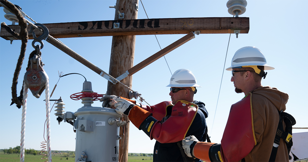
One of the first steps was to introduce iPads to the line workers, so they could access the map at any time and any place. Sellmeyer then began to go through each substation, feeder by feeder, looking at every transformer and meter to ensure all the information was the same as it was in iVUE Service. If she ran across anything that seemed “off,” she sent a service order to the line crews so they could look into it.
“There were times at the beginning of the project when I would get really frustrated, because I would think I fixed something and then 10 more errors would show up,” Sellmeyer said. “It was frustrating, but I know now that that’s what needed to happen to get to the root of the problems. Once I overcame my initial frustration and kept at it, I began to see progress and think, ‘OK, I am on the right track’ because I started to see those errors going down.”
OA not only provides insight into the number of errors but also includes tools to help NOEC find the cause of the errors. Following are some of the OA features NOEC used to help discover and resolve errors.
- The ability to check transformer loads. A graph in OA showed that one of their transformers was critically overloaded. Sellmeyer sent a service order to check the transformer, and line workers confirmed and addressed the issue. Being able to see this in real time helped prevent an outage.
- Graphs and charts that show visual representations of regulator voltages. One such graph showed a voltage spike, and after investigation by line workers, the problem was found and addressed.
- Visual representations of meter voltages. Graphs are regularly used to spot unusually low or high voltage. In one instance, a graph in OA showed irregular voltage issues on a meter. Sellmeyer sent a service order and line workers discovered a line clamp failure. The line clamp was replaced and the voltage evened out, preventing an outage.
- Graphs that indicate issues with claw line connectors on transformers. A line worker was working in OA and noticed a voltage variation. Upon investigation, line crews found that a hotline connector was arcing. The same issue was found in about a dozen other transformers and OA led them to the tap so they didn’t have to physically check every transformer.
- Visual representations showing increased transformer voltage. Increased voltage at the transformer can indicate internal transformer issues or bad connections, so it is very important that this is resolved to prevent damage to customer equipment. Line workers caught increased voltage in several transformers, allowing them to replace them before they caused further issues.
- Graphs that point to potential issues with regulators and capacitors. A graph in OA showed a spiked voltage that then leveled out without any intervention. Sellmeyer said that let them know to monitor that regulator or capacitor for potential problems.
OA is an extremely useful tool in finding potential problems, but line workers are an indispensable part of the process. They are the ones who take the service orders, which up until that point are just indications of problems, then physically examine the equipment to determine whether there is an issue, and if there is, to fix it. Because of their importance to the project, it is essential that Sellmeyer got their buy-in.
“When I began sending service orders out – and there were A LOT of them – the linemen weren’t too happy about it,” Sellmeyer said. “They asked, ‘don’t you already have all this?’ and I had to assure them that I didn’t.”
“The initial buy-in from the linemen was a little rough,” echoed Jeff Luker, NOEC’s Director of Engineering Services, “but when we began working with Jaimie and looking at the map to see what she was doing and realized how it would help them do their jobs, we were all on board. It became obvious that an improved map would really help troubleshoot issues and save time, especially when they get called out in the middle of the night or during an outage.”
About a year later, those 5,000 critical errors have all been resolved and efficiency has increased tremendously, especially when it comes to outages. “Not having to run all over trying to chase down and troubleshoot an outage saves us a lot of time,” said Tim Wilson, NOEC’s Vinta Operations Superintendent. “The map tells us what is upstream and what is downstream, which is very helpful. In years past, we were bypassing breakers and seeing blinking lights or chattering because lines were overloaded. Now, we have pretty much eliminated that. There are just a handful that we catch here and there.”
The project also included mapping of the system’s underground infrastructure, which also led to significant efficiencies for line workers. This part of the project required Sellmeyer to come up with creative ways to map underground infrastructure so line workers could “see” open points, junction cans and which elbows were open or closed by simply looking at the map. “One night when I was at home, I was sitting on the couch pondering how to map these things out, and I came up with the idea of using busbars,” she said. “The next day I ran the idea by NISC and they couldn’t see why that wouldn’t work, so I used them to create a ghost assembly to represent the elbows inside of the junction cans. The linemen love this because it gives them a clearer picture of how things are connected in the underground systems.” This innovative solution has helped reduce outage times – sometimes by as much as half.
“What Jaimie has done with the underground is leaps and bounds over anything I’ve ever seen,” Luker said. “Before it was mapped out, we’d waste time driving 20 miles when the problem was in a device 20 miles in the other direction. The accuracy we have now has saved us a lot of milage.”
While not all of NOEC’s underground is mapped out yet, Luker said that what is mapped out makes the line workers’ jobs much more efficient. “The guys can get on the map and — bam! They’re not guessing what transformer is on what phase – they can look at it right there on the iPad, and it’ll take them right to it. And when you’re trying to leapfrog transformers, trying to get power back on during an outage, you’re not having to open every transformer.”
“The whole project was a group effort – it still is,” Sellmeyer said. “I always tell the linemen that they are my eyes. I count on them to let me know when changes happen as a result of events like tornadoes or when they see something that needs to be fixed or updated on the map.”
“And when the linemen are out in the field and they find something that isn’t accurate, you can bet Jaimie will have a Teams message or call the next morning to get it corrected,” Luker said. “They see firsthand the advantages an accurate map provides and it’s a 110% buy-in around here now.”
“This ‘it takes a village’ approach is very important,” said Harold Christopher, NISC’s OA Product Manager, who sees firsthand the many benefits utility systems see from having accurate maps and energy system models. “Having the involvement and buy-in of all the stakeholders in the organization is a necessary piece to ensuring not only an accurate map, but more efficient and streamlined operations throughout the entire system.”
Today, with the buy-in of the entire organization, NOEC works hard to maintain their map, and the errors it has on any given day are minimal. Because of this, they are able to use OA and DEW to their full potential. Christopher said that of all system models he sees across all NISC Members, the accuracy of NOEC’s model is in the top 6%, a source of pride for all who worked to get the project to where it is. And now that the map is accurate, the NISC enterprise is working just as it is designed, meaning efficiencies gained across the organization.
Looking back at the project, there is only one thing they all agree they would do differently – and that is to start it sooner. “Now that the project has been completed, we feel very confident in our mapping system and engineering model,” Sellmeyer said. “Our data is in excellent shape, and having an accurate map has saved us a lot of time and money in overtime and truck rolls, especially after hours and on weekends. Seeing how spot-on everything we discovered with OA has been, we are more confident both with using it and knowing the value it brings to our organization.”
For more information on how OA and DEW can help you analyze your system and solve your biggest electric distribution problems, contact us at 866.999.6472 or visit nisc.coop.